

2019 ·
2018 ·
2017 ·
2016 ·
2015 ·
2014 ·
2013 ·
2012 ·
2011 ·
2010 ·
2009 ·
2008 ·
2007
2006 ·
2005 ·
2004 ·
2003 ·
2002 ·
2001 ·
2000 ·
1999 ·
1998 ·
1997 ·
1996 ·
1995
 · What is RSS?
GGE News - 2007
- GGE Students Participate in a Google Sponsored Contest
- Graduate Seminar Conference
- GGE Students Make a Difference in Brazil
- Malawi Update: UNB Staffers Visit Mzuzu University
- Master's Student Wins First Prize in Paper Competition
- The Brazilian National Geospatial Framework Project: An Update
- More News from the Arctic
- GGE Wins Pumpkin Carving Contest for the Second Year in a Row
- Another GGE Award
- Richard Langley Wins the 2007 ION Kepler Award
- The Ocean Mapping Group - Still Making News in the Arctic
- UNB Chosen as One of Canada's Absolute Gravity Sites
- Eighteen GGE Undergraduates Make the Dean's List
- Jill Cheverie Makes News in Saskatchewan
- Chris Gairns Wins the St. George Tri Fest Canadian Long Distance Duathlon
- Dr. Anna Chrzanowski Receives the Doctor Habilitatus Degree
- UNB's Prof. Richard Langley Named Fellow of The Royal Institute of Navigation
- Robbie Kingdon in Malawi
- Brazil Update 2007
- Eight GGE Students Attend The Atlantic Institute Graduate Research Conference
- Dave Coleman Inducted into Canadian Academy of Engineering
- GGE Professors and Students Present Papers at the US HYDRO 2007 Conference
- Geocaching with Doaktown Consolidated High School
- John Hughes Clarke Speaks to Parliamentarians
- Graduate Seminar Conference 2007
- Undergraduate Technical Conference 2007
- Don Kim Leads a Joint GPS Research and Development Project
- Willis Roberts Establishes GGE Scholarship
- GGE Professors and Students Visit the University of New Hampshire
GGE Students Participate in a Google Sponsored Contest
 During the winter and spring of 2007, Google sponsored a contest for students open to all universities across North America. The objective was to use Google SketchUp software to create a 3D reconstruction of their campus. Geodesy and Geomatics Engineering at UNB answered the call and a team of 10 individuals worked tirelessly to digitally reproduce over 60 buildings on campus. The team was led by Tristan Goulden and included Alix d'Entremont, Ben Doherty, Burns Foster, Chris Fox, Erin Grass, Harsil Jani, Suresh Jeyaverasingam, Sarah Moore, and Landon Urquhart. Although the team narrowly missed a top finish, the product that was produced is featured in Google's 3D warehouse at
http://sketchup.google.com/3dwarehouse/cldetails?mid=a53ab55e821c56c1fe2a5ce568a518ff&prevstart=0
More ...
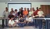
Graduate Seminar Conference

On November 29, the Department held its semi-annual Graduate Seminar Conference. Liliána Sükeová organized the event and chaired the session.
Click here to look at the conference program.
Click on the thumbnail image to look at photos taken following the conference, 62 KB.
GGE Students Make a Difference in Brazil
 During the week of November 7th to the 15th, the Department hosted 13 visitors from Brazil. The visitors were here under the auspices of a Canadian International Development Agency (CIDA) project in Brazil, which is managed by UNB. The overall goal of the project is to improve the geomatics infrastructure in Brazil and it has several important social components, touching the lives of many Brazilians.
More ...
Malawi Update: UNB Staffers Visit Mzuzu University

In October, Sue Nichols (GGE),Veronica McGinn and Ian Methven (Centre for Property Studies) visited Mzuzu University in Malawi to follow up on the UNB internship of Robert Kingdon, a GGE graduate student. The other purpose of the visit was to begin developing long term ties between GGE and the Land Management Department at Mzuzu University including finding funding for equipment, books, and exchanges among professors and students. The visit included meetings with CIDA, the Malawian government, the World Bank and the administration at the university.
Click on the thumbnail image to look at photos taken during the visit, 108 KB.
Master's Student Wins First Prize in Paper Competition

Congratulations to Master's student Terry Johnston for winning first prize in the Student Paper/Poster Competition at the National Ocean Management and Research Network (OMRN) (www.omrn-rrgo.ca) Conference held October 24-27 in Ottawa. Her paper "Implementation of GIS: Technology is not Enough to Ensure Success" explored the issues related to building an effective spatial data infrastructure at the St. Andrews Biological Station. Terry is supervised by Prof. Sue Nichols.
Click on the thumbnail image to get a better look, 33 KB.
The Brazilian National Geospatial Framework Project: An Update
 The National Geospatial Framework Project hosted a number of activities in October in Rio de Janeiro. From the 22nd to the 24th, the project participated in the Brazilian Congress of Cartography as an exhibitor. A conference booth was set up and used for a series of project demos for conference participants. During the event, the second issue of the project magazine "Ponto de Referencia" was launched.
More ...
More News from the Arctic
 On Monday, August 6, 2007 the CCGS Amundsen stumbled upon a previously uncharted shoal some 75 km away from the mainland in eastern Hudson Bay. On board were two Master's students from the GGE department, Steve Brucker and Ian Church. Both are students with the Ocean Mapping Group (OMG). The Amundsen was sailing under the flag of the ArcticNet project, a research program that is studying the impact of global warming on the Canadian coastal Arctic. One of its many goals is to add to existing bathymetric mapping coverage in the Northwest Passage and other parts of the Canadian Arctic archipelago. This is done with state-of-the-art multibeam echosounder instrumentation and supporting systems, all of which are operated by GGE undergraduate and graduate students as part of the OMG's role in the ArcticNet program.
More ...
GGE Wins Pumpkin Carving Contest for the Second Year in a Row
GGE has won the second annual Pumpkin Polooza hosted by the UNB Alumni Office. Thanks so much to Tracey Hawco Winchester who has outdone herself this year. Can't wait to see what she comes up with next year! For a look at the competition - http://alumni.unb.ca/photos/Pumpkin_Polooza_2007/Pumpkin_Polooza_2007.html
Click on the thumbnail image to get a better look at the winning entry, 61 KB.
Another GGE Award

GGE researchers grabbed a second award at The Institute of Navigation's 20th Satellite Division meeting held in Fort Worth, Texas, last month. Dr. Don Kim received a best presentation award for his paper entitled "Long-Range Single-Baseline RTK for Complementing Network-Based RTK," co-authored with Dr. Richard Langley. Well done!
Richard Langley Wins the 2007 ION Kepler Award
![]() The Department would like to congratulate Dr. Richard Langley who has won the 2007 Johannes Kepler Award from the Satellite Division of the Institute of Navigation (ION). The award is given "to honor an individual during their lifetime for sustained and significant contributions to the development of satellite navigation," according to the ION.
The Department would like to congratulate Dr. Richard Langley who has won the 2007 Johannes Kepler Award from the Satellite Division of the Institute of Navigation (ION). The award is given "to honor an individual during their lifetime for sustained and significant contributions to the development of satellite navigation," according to the ION.
The Department is very proud of this and Dr. Langley's many other accomplishments.
More ...
The Ocean Mapping Group - Still Making News in the Arctic
 Members of UNB's Ocean Mapping Group have been on the Canadian Coast Guard ship Amundsen recently, continuing to map the Northwest Passage. Ian Church and Steve Brucker were aboard the Amundsen in August. Jonathan Beaudoin is currently working aboard the Amundsen and Doug Cartwright and Steve Brucker are going for the month of October.
More ...
UNB Chosen as One of Canada's Absolute Gravity Sites
 During June 2007, over a two day period, Jason Silliker (GGE B.Sc.E 2000) of Natural Resources Canada (NRCan) made measurements at UNB using state-of-the-art equipment to determine the value of gravity at a point in the department's survey laboratory, Head Hall A17. The value of gravity will be determined from the measurements by scientists and engineers at Natural Resources Canada later this year. The new gravity reference point (marked by a small brass screw) will become part of a national array of absolute gravity observation sites collocated with geometric reference (i.e. precise continuous and episodic GPS) stations across Canada. UNB runs several continuously operating GPS reference receivers including a long running one which contributes its data to the International GNSS Service. To enable users of gravity to easily access the accuracy provided by this new point, an additional gravity point was established outside near the entrance to Head Hall.
More ...
Eighteen GGE Undergraduates Make the Dean's List
 Eighteen students from Geodesy and Geomatics Engineering have made the Dean's List for 2006-2007. The students who qualified for the list attained a sessional grade-point average of at least 3.7 or A- for the academic year. Congratulations go out to the following students:
| Fredericton, NB | Suresh Jeyaverasingam |
|---|---|
| Alexander Snyder | |
| Harvey Station, NB | Joseph Chessie |
| Homesville, NB | Mark Guest |
| Mactaquac, NB | George McKessock |
| Botwood, NF | Blair Bridger |
| Truro, NS | Mark Hatcher |
| Ryan Moore | |
| West Bay, NS | Landon Urquhart |
| Charlottetown, PEI | Sarah Moore |
| Summerside, PEI | Genevieve Baker |
| Ajax, ON | Christopher Fox |
| Deep River, ON | Ian Cleland |
| Toronto, ON | Rory O'Connell |
| Fort McMurray, AB | Matthew Webb |
| Vulcan, AB | Clark Langridge |
| Vancouver, BC | Ivan Detchev |
| Bulgaria | Ofeliya Popova |
Jill Cheverie Makes News in Saskatchewan
![]() Jill Cheverie graduated from Geodesy and Geomatics Engineering in the spring of 2004. Since then, she has been working with Midwest Surveys Inc. in Maple Creek Saskatchewan. Jill made headlines recently when, on August 13, she became the first woman to hold the commission of Saskatchewan Land Surveyor.
Jill Cheverie graduated from Geodesy and Geomatics Engineering in the spring of 2004. Since then, she has been working with Midwest Surveys Inc. in Maple Creek Saskatchewan. Jill made headlines recently when, on August 13, she became the first woman to hold the commission of Saskatchewan Land Surveyor.
"It is a great honour for me to receive this commission and I truly appreciate all the support and encouragement that I have received through both the academic phase of my learning at the University of New Brunswick, as well as the hands-on practical phase with Midwest Surveys in Maple Creek" said Ms. Cheverie.
See the Regina Leader-Post article for more.
Congratulations Jill.
Chris Gairns Wins the St. George Tri Fest Canadian Long Distance Duathlon
 Congratulations to GGE M.Sc.E. student, Chris Gairns, on his recent 1st place duathlon finish. He dominated at the St. George Tri Fest Canadian long distance duathlon championships in St. George on Sunday, July 15.
More ...
Dr. Anna Chrzanowski Receives the Doctor Habilitatus Degree
 On May 29, 2007, Dr. Anna Chrzanowski received the highest university degree of doctor habilitatus at the University of Warmia and Mazury in Olsztyn, Poland. Doctor habilitatus is the highest academic qualification that a person, who already holds a Ph.D. degree, can achieve by his/her own pursuit in certain European countries in which the habilitation qualifies the holder to become a university professor and supervise doctoral candidates. The habilitation qualification exists mainly in central and east European countries, e.g., in Austria, France, Germany, Poland, and Switzerland. The process of habilitation, derived from the Latin habilitare which means "to enable", was introduced in the 18th century. Candidates for the degree doctor habilitatus must submit a dissertation in their field of expertise, present a colloquium summarizing their achievements, and give a lecture on a topic selected by the degree-granting committee. The reviewers of the dissertation are selected by a national scientific committee.
More ...
UNB's Prof. Richard Langley Named Fellow of The Royal Institute of Navigation

The Royal Institute of Navigation has elected UNB's well-known GPS expert, Prof. Richard Langley, as one of its new fellows for 2007. The award was made at the RIN's 60th anniversary annual general meeting in London, on June 29th.
This was the first meeting under the RIN's new royal charter, awarded by The Queen, last November.
The RIN elects fellows for recognition of a particular achievement in the field of navigation or to those who have made a continuing contribution to the development of navigation.
During the presentation, RIN president, Prof. David Last, remarked that Prof. Langley was elected a fellow "for his outstanding contribution to research and education in satellite navigation and geodesy over a sustained period, and as a coordinating editor of GPS World magazine since its inception."
More ...
Robbie Kingdon in Malawi
 Malawi is a country of challenges. Bounded by Mozambique, Zambia and Tanzania, it is a landlocked country of approximately 13 million persons most of whom are involved with subsistence farming and live in the south and middle portions of the country. The United Nations Development Program places Malawi 166th of 177 countries included in its Human Development Index for 2006 (Canada ranks 6th). According to the UNDP, life expectancy at birth is 39.6 years and national GDP per capita is US $646 (2004) in a country which has seen its population more than double in the last thirty years. Tea, sugar and tobacco are the major export products.
More ...
Brazil Update 2007
 There were many highlights within Dr. Nichols' fourth trip to Brazil as part of the National Geospatial Framework Project. For example: she attended the official celebration of the Mangueira Women's Association's involvement with the CIDA project and she delivered gifts to the Quilombola Castainho donated by the faculty, students and staff of the Department of Geodesy and Geomatics Engineering. A trip was also taken to Paraty, where Dr. Nichols met with an indigenous group who will be working with the project in the future.
More ...
Eight GGE Students Attend The Atlantic Institute Graduate Research Conference
 UNB graduate students fared well at this year's edition of The Atlantic Institute Graduate Research Conference held June 13-15, 2007 at the Schoodic Education and Research Center on the Schoodic Peninsula in coastal Maine.
Tristan Goulden received the "Best Presentation" award for his presentation entitled "Towards quantifying uncertainty resulting from terrain effects in airborne lidar observations".
Jianfeng Zhao received the "Best Visual Presentation" award for her presentation "An empirical assessment of web-based PPGIS prototype".
The Atlantic Institute promotes the ongoing regular exchange of research ideas and experiences among graduate students and faculty at Laval University, the University of Maine, and the University of New Brunswick. The research seminar rotates among the three institutions.
Program details are available here.
Click on the thumbnail image to get a better look, 38 KB.
Dave Coleman Inducted into Canadian Academy of Engineering
![]() Dave Coleman was one of 24 new fellows inducted into the Canadian Academy of Engineering (CAE) this month. The CAE is comprised of Canada's most accomplished engineers. Members of the Academy are nominated and elected by their peers for distinguished achievements and service to the engineering profession.
Dave Coleman was one of 24 new fellows inducted into the Canadian Academy of Engineering (CAE) this month. The CAE is comprised of Canada's most accomplished engineers. Members of the Academy are nominated and elected by their peers for distinguished achievements and service to the engineering profession.
"Fellows of the Academy are committed to ensuring that Canada's engineering expertise is applied to the benefit of all Canadians."
Read the associated UNB news release.
GGE Professors and Students Present Papers at the US HYDRO 2007 Conference
 Professors David Wells and John Hughes Clarke, and graduate students Ian Church, Andres Millan, Aluizio Oliveira and Steve Brucker presented several papers in the 11th biennial U.S. Hydrographic Conference US HYDRO 2007, held in Norfolk (Virginia, USA) from 14th to 17th May.
More ...
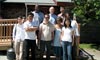
Geocaching with Doaktown Consolidated High School
 The Department hosted students and teachers from Doaktown Consolidated High School on May 22 for a geocaching event. Students were divided into groups of four and then used a GPS receiver to navigate to six waypoints around campus with a cache located near each group's last waypoint. The students finished their visit with us with pizza for lunch and a short lesson in mapping in 3D. (Photo: Sheri Brokopp, 2007-May-22)
Click on the thumbnail image to get a better look, 32 KB.
Click here to learn more about geocaching.
John Hughes Clarke Speaks to Parliamentarians
 On April 19, John Hughes Clarke spoke to parliamentarians in Ottawa with a presentation entitled "Ocean Mapping - A New Tool for Exploring and Managing Canada's Vast Offshore Resources." Dr. Hughes Clarke's talk was one of a series of monthly breakfast meetings organized by The Partnership Group for Science and Engineering (PAGSE). PAGSE is a group of science and engineering organizations formed at the invitation of the Royal Society of Canada to represent the Canadian science and engineering community to the Government of Canada. The breakfast meetings, dubbed "Bacon and Eggheads," are co-sponsored by the Speaker of the Senate, the Speaker of the House of Commons, and the Natural Sciences and Engineering Research Council of Canada.
Abstract:
Powerful new developments in undersea mapping can now offer up stunning high-resolution panoramas of the hitherto inaccessible world of Canada's ocean shelves. For University of New Brunswick Professor John Hughes Clarke and colleagues, it's a technological revolution that will provide answers to a host of important questions such as what exactly does the Arctic sea floor look like, where are the important ecological habitats, what are the areas at risk for tsunami-generating landslides, and where do natural hydrocarbons vent and seep from the ocean floor. Dr. Hughes Clarke will discuss the science behind the latest mapping advances and explain why these new technologies will become essential tools for defining and protecting our offshore frontiers and for laying the groundwork for the possible future use of their resources. He will also introduce us to Canadian companies that aim to lead the world in developing instrumentation and integrated systems for sensing and visualizing ocean data.
Graduate Seminar Conference 2007
 The Graduate Seminar Conference 2007 (conference program) took place April 5 with 16 graduate student presentations on remote sensing, marine policy, GIS, surveying, hydrography, and GPS.
More ...
Undergraduate Technical Conference 2007
 The Undergraduate Technical Conference 2007 took place over March 27 and 28. The conference culminates the students' work in the technical report course GGE4711. Thank you to graduate students Tristan Goulden and Ian Church who coordinated 28 undergraduate presentations including the CIG Undergraduate Paper Competition.
More ...
Don Kim Leads a Joint GPS Research and Development Project
 Centimetre-level high accuracy GPS positioning in real time for either high speed racing cars or slow moving heavy duty cranes at every corner over a region or an entire country is not a dream any more. The demand for precise and reliable positioning in real time under kinematic conditions is increasing in the industrial as well as in the consumer field. Unfortunately, the current single-baseline RTK (real-time kinematic) positioning technologies are not good enough to satisfy all the needs arising. Industrial and commercial activities could be made more cost-effective and even new services launched if precise and reliable positioning would be possible at all times and in all places. Network-based RTK offers an ideal solution to meeting such a demanding challenge.
Recently, UNB and the Korea Astronomy and Space Science Institute have signed a research and license agreement for $270,000 over three years to jointly develop network-based RTK software, which will enable it to achieve centimetre-level high accuracy positioning in real time over the South Korea peninsula. As the principal investigator, Dr. Don Kim will lead this international joint research and development effort. Further opportunities for the commercialization of network-based RTK have been discussed among the groups with interest in the project, including automobile companies, electronics companies, TV/radio broadcasting companies, research institutes, and the South Korean government.
Willis Roberts Establishes GGE Scholarship
![]() Willis Roberts, a pioneer in land surveying, and his two daughters have donated $55,000 to the University of New Brunswick in Fredericton to establish a scholarship in geodesy and geomatics engineering. The scholarship will benefit New Brunswick students.
Willis Roberts, a pioneer in land surveying, and his two daughters have donated $55,000 to the University of New Brunswick in Fredericton to establish a scholarship in geodesy and geomatics engineering. The scholarship will benefit New Brunswick students.
"This gift comes from a visionary in the surveying profession who has helped make UNB and New Brunswick world leaders in the field," said John McLaughlin, president of UNB. "It was in the 1950s that Dr. Roberts provided the impetus for the creation of UNB's world-renowned geodesy and geomatics engineering department. Through gifts like his, students are encouraged to pursue their interest in this field and benefit from the excellence of UNB's programs."
More ...
GGE Professors and Students Visit the University of New Hampshire
 On the 29th and 30th of January, Dr. David Wells and Dr. Marcelo Santos, along with graduate students Miguel Vasquez and Andres (Andy) Millan, visited the Center for Coastal and Ocean Mapping (CCOM) (http://www.ccom-jhc.unh.edu/) at the University of New Hampshire.
Dr. Wells arranged meetings with Dr. Brian Calder to support Miguel's research on the use of the Combined Uncertainty and Bathymetric Estimator (CUBE) in high-sloped coastal areas. Dr. Wells also arranged meetings with Dr. Lee Alexander and the Chart of the Future team (Colin Ware, Kurt Schwehr, Briana Sullivan) to exchange concepts with Andy about navigational visualization products applied to sailing direction development.
Dr. Santos and Dr. Wells met with Dr. Jim Gardner and Dr. Lloyd Huff concerning the research project of Nathan Wardwell, who will be using data collected during the Princess of Acadia Project.
Dr. Wells also brainstormed with Michelle Weirathmueller (GGE grad and CCOM grad student) about setting up calibration observation equations for the CCOM Harbor Observatory Nodes that measure directions for vehicles in the water column.
Click on the thumbnail image to get a better look, 25 KB.