

2019 ·
2018 ·
2017 ·
2016 ·
2015 ·
2014 ·
2013 ·
2012 ·
2011 ·
2010 ·
2009 ·
2008 ·
2007
2006 ·
2005 ·
2004 ·
2003 ·
2002 ·
2001 ·
2000 ·
1999 ·
1998 ·
1997 ·
1996 ·
1995
 · What is RSS?
GGE News - 1998
- UNB Well Connected at Recent GSD Stakeholder Meeting
- OMG Helps Map Lake Tahoe in California
- UNB Geodesy and Geomatics Researchers Play Important Roles in New NCE Multimillion Dollar Research Award
- Sutherland for Pres
- Department Acquires Two New Professors Emeriti
- Komjathy Awarded Governor General's Gold Medal
- Retirement Revisited
- UNB Involved in Swissair Flight 111 Debris Search
- "Larry Mayer is a Man Who Parts Seas for a Living."
- University Research Ranking Results
- GGE Researchers Given Best Paper Award at ION GPS-98
- FAO Technical Seminar
- Edward Popiolek Visits Adam Chrzanowski
- President Parr-Johnston Visits Department
- ABLOS, GALOS Get-Together
- Dave Wells in Malaysia
- Checking Out the Cadastral Atlas in Mozambique
- Sunil Bisnath 1998 GAC Scholarship Winner
- Peter and Paul Become Langley Disciples
- David Wells and Adam Chrzanowski Retire
- Engineering and Mining Surveys Group in Pakistan
- The Globe and Mail Features Mayer
- Mayer Wins 1998 Keen Medal
- Angus Hamilton Lecture Series Brings Astronaut Julie Payette to Fredericton
- CIG Fredericton Branch April 1998 Undergraduate Paper Competition
- Life on a Geocentric Datum. Geodesy: What is it and Why do we do it?
- Fourth Coastal Multibeam Sonar Training Course
- Canada Lands Survey System Meeting
- New Program Caters to Geomatics and Information Technology Markets
- Spectacular Finishes and New Beginnings
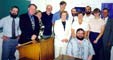
UNB Well Connected at Recent GSD Stakeholder Meeting
 At a stakeholder-feedback-and-planning-for-the-future workshop, held in Ottawa on 3 and 4 December 1998, more than half of the invited speakers, it turns out, have had close ties to our department. This workshop was for all Natural Resources Canada, Geodetic Survey Division staff, and featured presentations from the international, provincial, academic, and industrial sectors. The participants heard from 11 speakers who put forward suggestions concerning the role and mandate of the GSD.
Click on the thumbnail image to get a better look at the participants and to discover the participants' links to UNB, 27 KB.
OMG Helps Map Lake Tahoe in California
 The cover story in the November 1998 issue of POB Point of Beginning features the Lake Tahoe survey done by Jim Gardner of the United States Geological Survey in collaboration with the Department's Ocean Mapping Group. The full details of the survey, "The Bathymetry of Lake Tahoe, California-Nevada", co-authored by Larry Mayer and John Hughes Clarke, can be found on line.
UNB Geodesy and Geomatics Researchers Play Important Roles in New NCE Multimillion Dollar Research Award
In addition to playing an early role in the formation and design of the GEOIDE NCE, four members of the geodesy and geomatics engineering department are heavily involved in 8 of the 20 research projects included in the NCE's program. The four professors are Dr. Richard B. Langley, Dr. Petr Vaníček, Dr. David J. Coleman, and Dr. Michael Collins. Dr. Brad Nickerson (a B.Sc.E. and M.Sc.E. graduate from our department), with the Faculty of Computer Science, will be working with Dr. Coleman in one of the eight areas of research. The projects in which they are involved are:
- Natural Hazards and Disaster Monitoring (Langley and Vaníček).
- Improvement of Precise and Reliable Kinematic GPS Positioning in Real-time Over Long Distances for Bathymetric Surveys (Langley as team co-leader).
- Synergistic Use of Multi-sensor Remote Sensing for Monitoring of Earth's Surface and Atmosphere (Collins as team co-leader).
- Airborne Gravity for Exploration and Mapping (Langley).
- Integrated Decision Support System for Watershed and Coastal Zone Management (Coleman).
- Real-Time Mapping and Sensor Integration in Support of Geospatial Information Systems (Collins).
- Precise Geoid Determination for Geo-referencing and Oceanography (Vaníček).
- Designing the Technological Foundations of Geospatial Decision-Making Using the World Wide Web (Coleman and Nickerson).
The GEOIDE NCE is directed by Prof. Keith Thomson at Université Laval in Québec City. More detailed information concerning both GEOIDE and the NCE program may be found on their Web sites.
Read the associated UNB news release.
Click on the thumbnail image to get a look at the GGE members involved, 30 KB.
Sutherland for Pres
Department Acquires Two New Professors Emeriti
 On Sunday, 25 October 1998, fall Convocation was the scene of a ceremony involving two "retired" members of our department. Both Adam Chrzanowski and David Wells have been awarded Professor Emeritus status. Parchments commemorating the event were presented, and, rumour has it, both will have their library cards re-validated. No particular official duties will be expected of our Professors Emeriti, however, they may be called upon to give advice and counsel, and they plan to carry on with their various research endeavours.
Read the associated UNB news release.
Click on the thumbnail image to look at some pictures taken before and during the ceremony, 265 KB.
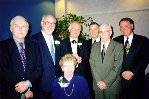
Komjathy Awarded Governor General's Gold Medal
 Former graduate student, Attila Komjathy, has won UNB's 1998 Governor General's Gold Medal for academic excellence in graduate studies. Attila, who worked with Prof. Richard Langley, returned to Fredericton to pick up the award, and to give a special lecture on "Application of GPS as a New Remote Sensing Tool: Retrieval of Ocean Surface Wind Speed." The subject of his Ph.D. thesis is "Global Ionospheric Total Electron Content Mapping Using the Global Positioning System." This thesis has been made into departmental technical report No. 188.
Click on the thumbnail image to look at some pictures taken during Attila's visit, 131 KB.
Retirement Revisited
 Why are we still talking about the retirements of Adam Chrzanowski, David Wells, and Noreen Bonnell? Because retirement events just keep going, and going, and going (similar to that very obnoxious bunny). This should be, however, the end of the business.
Click on the thumbnail image to look at some pictures taken during the festivities, 232 KB.
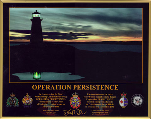
UNB Involved in Swissair Flight 111 Debris Search
Update: the Swissair seabed search data are no longer restricted.(February 1999).
For our efforts, GGE received a letter and certificate of appreciation (March 1999).
"Larry Mayer is a Man Who Parts Seas for a Living."
Click on the thumbnail image to go to the Ocean Mapping Group's home page.
University Research Ranking Results
A ranking of one means that the department has indicated a major commitment to research and scholarship. This commitment is indicated through favourable external recognition involving such factors as an excellent record of adjudicated publications and presented papers, a high level of financial support in those disciplines where such support is appropriate and available, recognition of scholarly expertise through appointments of members to editorships, grant selection committees, and as journal referees, etc. Where a graduate program exists, the program is considered to be of high quality, productive, and attractive to students.
GGE Researchers Given Best Paper Award at ION GPS-98
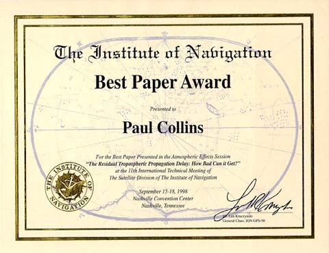 The Institute of Navigation selected a paper authored by Paul Collins and Richard Langley as the best paper in the Atmospheric Effects session at the ION GPS-98 conference held in Nashville, Tennessee, in September. The paper, "The Residual Tropospheric Propagation Delay: How Bad Can it Get?", was published in the proceedings of the meeting and is available from one of our Web sites as a PDF file.
Click on the thumbnail image to get a better look, 33 KB.
FAO Technical Seminar
 In late September 1998, the Food and Agriculture Organization sponsored its second high level technical seminar on Private and Public Sector Cooperation in National Land Tenure Development. This year the focus was on Black Sea countries with additional presentations from Australia, the Netherlands, Canada (Sue Nichols), and Italy. The venue was an old monastery and fortress atop a mountain in northeastern Italy.
Click on the thumbnail image to get a better look at some of the participants, 34 KB.
Edward Popiolek Visits Adam Chrzanowski
 As part of the continuing relations between the Canadian Centre for Geodetic Engineering at UNB and the Mining and Metalurgy University of Krakow, Prof. Dr. Popiolek visited the Department between 29 September and 1 October 1998. Dr. Popiolek met with both Anna Szostak-Chrzanowski and Adam Chrzanowski in connection with their cooperative research agreement. This research involves analysing ground subsidence around copper mines in Poland.
Click on the thumbnail image to get a better look, 21 KB.
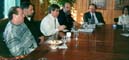
President Parr-Johnston Visits Department
 On 4 September 1998 we were privileged to have the opportunity to show University President, Liz Parr-Johnston, our departmental facilities. She was given tours of the Satellite Observatory and GPS Lab, the Geographic Engineering Lab, and the Ocean Mapping Group's Visualization Lab. Dr. Parr-Johnston then met with faculty and staff in an informal setting. Chair David Coleman presented a short overview of the department's plans, our areas of expertise and excellence, and our aspirations for the future. Dr. Parr-Johnston responded that she already knew of our reputation, and that she was a strong booster of the Department in her travels world-wide.
Click on the thumbnail image to get a better look at some of the people on hand for the occasion, 24 KB.
ABLOS, GALOS Get-Together
 The 5th meeting of the IHO/IAG/IOC* Advisory Board on the Law of the Sea (ABLOS) gathered in Fredericton 2-3 September 1998. This was followed on 3-4 September by the annual meeting of the IAG committee on the Geodetic Applications in the Law of the Sea (GALOS). ABLOS members came from Canada and from 8 other countries. Items of interest to Canadian geodesists included Article 76 issues of baselines, data assembly and the Gardner Line, and special problems of the Arctic Ocean. Twenty-one members of the GALOS committee represented 15 countries. Such topics as low astronomical tide as a chart datum; geodetic problems related to Article 76, and errors in maritime boundaries were discussed. Of international interest was a presentation by Ron Macnab of the Geological Survey of Canada. He revealed that, through the UN, Canada is seeking to have its 200-nautical mile offshore limit extended by 150 miles in some areas of Atlantic Canada.
Read the associated story that appeared in the New Brunswick Telegraph Journal.
*IHO = International Hydrographic Organization; IAG = International Association of Geodesy; IOC = International Oceanographic Commission.
Click on the thumbnail image to get a look at some of the hard-working attendees, 37 KB.
Dave Wells in Malaysia
Surveying on the Equator
 In August, Dave Wells was one of the instructors of a hydrography course at the Universiti Teknologi Malaysia (UTM). As part of the course, students had to perform a survey in the Johor Strait between Malaysia and Singapore.
Two teams from the Hydrographic Cat B class competed to acquire the highest number and highest quality hydrographic data points within a 90 minute deadline. The team styling themselves as "Garfield Hydrographic Stn Bhd" won the competition by collecting 1178 depths, 75% of which were within less than 10 metres deviation from the planned survey lines. The second team, styling themselves "Team Hydro Malaysia", trailed close behind with 1036 depths, 65% of which were within 10 metres of the planned survey lines (this team also finished 10 minutes faster than did the winners). The DGPS system used for vessel track control was a Trimble DSM Pro tracking a marine beacon transitter in Singapore. This system provided WGS 84 coordinates clustered within about 50 cm, but offset by 3m from WGS 84 control point "Kastam" established in June jointly by the Malaysian and Singaporean governments: coordinates 1-22-13.6628N, 104-5-19.3820E. The GGE Department, Canadian Hydrographic Association, and Canadian Hydrographic Service have all supported the establishment of this Cat B course in Malaysia over the past decade. Dave Wells has been one of the instructors for the past three years.
Click on the thumbnail image to look at pictures Dave took during the survey, 222 KB.
Checking Out the Cadastral Atlas in Mozambique
 Sue Nichols visited Beira during her assignment in Mozambique in August 1998. The Swedish International Development Agency (SIDA) has a long-term project to upgrade the surveying and mapping organization Direcção Nacional de Geografia e Cadastro (DINAGECA) and Sue is a monitor for SIDA.
Click on the thumbnail image to get a better look, 33 KB.
Sunil Bisnath 1998 GAC Scholarship Winner
Click on the thumbnail image to go to Sunil's personal page.
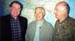
Peter and Paul Become Langley Disciples
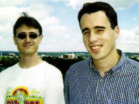 Peter Stewart (M.Sc.E. 1997) has recently become a Research Assistant in the Department. Prior to entering UNB as a student, Peter gained an honours degree in topographic science from the University of Glasgow in Scotland. Upon graduation from UNB in 1997, Peter returned to Scotland where he was employed as GPS Systems Engineer for Concept Systems Ltd., a world leader in the provision of navigation systems to the oil exploration industry. Since March 1998, Peter has been researching the effects of ionospheric delay on the proposed Wide Area Augmentation System (WAAS), specifically with regard to Canadian airspace.
Paul Collins, also recently raised to the rank of Research Assistant, graduated from the University of East London, England, in 1993 with a B.Sc. (Hons) degree in surveying and mapping sciences. He entered UNB's graduate school in 1994 and has been working on his M.Sc.E. degree in geodesy and precise navigation. Collins is investigating the effects of the troposphere on GPS positioning, with particular emphasis on WAAS, which aims to facilitate safe and reliable aircraft navigation using GPS.
The Langley-supervised work of both Stewart and Collins is being funded by Nav Canada, the recently formed not-for-profit corporation that has taken over air traffic control and navigation services from the federal government. NavCan is in partnership with the Federal Aviation Administration (FAA) on the implementation of WAAS in the United States and Canada.
Click on the thumbnail image to get a better look at the pair (Paul is on the left; Peter on the right), 26 KB.
retire (ri tïr') v. -tired, -tiring. 1 give up an office, occupation, etc. 2 remove from an office, occupation, etc. 3 go away, especially to be quiet. 4 withdraw; draw back; send back. 5 go back; retreat.*
 Retire is what Adam Chrzanowski and David Wells were supposed to have done as of 30 June 1998: Adam after 34 years of service (he became a part-time lecturer at UNB in 1964), and David after 18 years (having arrived in 1980).
Although Adam has given up the teaching end of his career, he is still deeply involved in research and is supervising a tidy parcel of graduate students. David, however, will still be teaching his usual load of hydrography courses and supervising his graduate students. Wells took definition number 3 above literally and 2 days after retiring left for the United States, Japan, Singapore, Malaysia, and Australia. Now that's retirement!!
We wish them both well in this new phase of their lives, and are gratified to know that they will still be familiar faces in the corridors of the department.
Click on the thumbnail image to look at a couple of photos taken during a get-together to mark the occasion, 37 KB.
*Avis, W.S., P. D. Drysdale, R. J. Gregg, V. E. Neufeldt, and M. H. Scargill (1983). Gage Canadian Dictionary. Gage Educational Publishing Company, Toronto, p. 962.
Engineering and Mining Surveys Group in Pakistan
Click on the thumbnail image to look at some photos of the dam from various vantage points, 104 KB.
The Globe and Mail Features Mayer
As already mentioned in a previous item at this Web site, Mayer is the recipient of a large contract with the U.S. Geological Survey to map certain areas of the Pacific coast and the ocean around Hawaii. The technology, as developed by Mayer, John Hughes Clarke, and Colin Ware, was explained in detail in the article which then went on to cite several examples of how the technology is being put to good use.
The accompanying pictures show the skeleton of the ship, British Freedom, on the seafloor off Nova Scotia and a new view of the ocean floor in San Francisco Bay.
Our congratulations to Larry for the well deserved kudos reported by Mr. Judge.
Mayer Wins 1998 Keen Medal
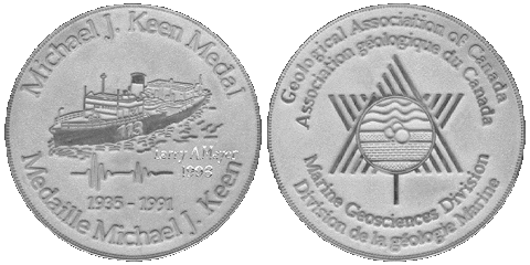 Larry Mayer, Ocean Mapping Group, is the 1998 winner of the Michael J. Keen Medal. This medal is awarded annually by the Marine Geosciences Division of the Geological Association of Canada to a scientist who has made a significant contribution to the field of marine or lacustrine geoscience.
At the annual meeting of the Geological Association of Canada (GAC), held in Quebec in May, Mayer was presented the medal by Kathryn Moran in recognition of his outstanding contribution to marine geosciences.
We add our congratulations to those of the GAC.
Click on the thumbnail image to get a better look at the medal, 38 KB.
Angus Hamilton Lecture Series Brings Astronaut Julie Payette to Fredericton
 On 9 April 1998, Julie Payette, a Canadian Space Agency astronaut in training at NASA in Houston, was the featured speaker at this year's Angus Hamilton Lecture Series. Payette, an engineering graduate from McGill University with a Master's degree in computer engineering from the University of Toronto, is currently working towards a doctorate in electrical engineering at McGill. Payette is scheduled to participate in the construction of the International Space Station.
The Angus Hamilton Lecture Series was established by the Council of Maritime Premiers in honour of our former department chair and professor. The lecture series is organized by the Champlain Institute which in collaboration with the Canadian Institute of Geomatics and the University of New Brunswick, brought Payette to Fredericton.
An interesting sidelight to the noontime event was the encouraging turnout by the Canadian Association for Girls in Science. This organization numbers 152 public school girls in Fredericton, of which 104 attended Payette's presentation.
Click on the thumbnail image to view scenes from the event, 176 KB.
CIG Fredericton Branch April 1998 Undergraduate Paper Competition
 The semi-annual Undergraduate Paper Competition, sponsored by the Fredericton Branch of the Canadian Institute of Geomatics, was held in the ADI Multi-Media room in Head Hall on 2 April 1998.
The competition was judged by alumni Wayne Walsh (Branch Chairman) and Stephen Hartley as well as Adam Chrzanowski and Sue Nichols.
Click on the thumbnail image for more details, 18 KB. (Photo: James Secord, 2 April 1998)
Life on a Geocentric Datum.
Geodesy: What is it and Why do we do it?
On 23 March, Petr gave the 1998 C. Y. O'Connor lecture in the John Curtin Lecture Theatre on the university campus. He posed the question: Geodesy: What is it and why do we do it? This public lecture gave an overview of the history of geodesy, its current status, and what the future holds for this field.
Fourth Coastal Multibeam Sonar Training Course
 Between 2 and 9 March 1998, the Ocean Mapping Group conducted the Fourth United States/Canada Hydrographic Commission's Coastal Multibeam Sonar Training Course. This year the course was held in Victoria, B.C., in conjunction with and preceding the Canadian Hydrographic Conference.
Details are available for anyone interested in learning more about this course.
Click on the thumbnail image to look at course highlights, 191 KB.
Canada Lands Survey System Meeting
 In January 1998, experts on the Canada Lands Survey System gathered at UNB. This meeting was held in conjunction with a study being conducted by the university's Centre for Property Studies for the Legal Survey Division of Geomatics Canada. One prominent issue was the role of the Canada Lands Survey System in land claims settlements and potential self-government arrangements for first nations.
During the time the experts were in Fredericton, several came to the department to give guest lectures in the land administration area of our program. Mike O'Sullivan, Surveyor-General of Canada, Doug Culham, Deputy Survey-General of Canada, and Carl Freison, Underhill and Underhill of Whitehorse, Yukon, generously gave of their time to meet with our students.
Click on the thumbnail image to get a better look at some of the participants, 24 KB. (Photo: Sue Nichols, January 1998)
New Program Caters to Geomatics and Information Technology Markets
 An exciting new program at the University of New Brunswick in Fredericton, New Brunswick, Canada will fill the gap for specialists in the geomatics and information technology markets.
The concurrent degree program in computer science and geodesy and geomatics engineering will graduate students who combine an in-depth knowledge of computer science with expertise in satellite positioning, mapping, remote sensing and geographic information systems.
Graduates will receive two degrees - Bachelor of Computer Science and Bachelor of Science in Engineering - and be eligible for accreditation as an Information Systems Professional and registration as a Professional Engineer in Canada.
Offered jointly by the only Faculty of Computer Science in Canada and UNB's internationally recognized Department of Geodesy and Geomatics Engineering, the program is seeking applications from qualified individuals for the term beginning September 1998.
For additional information, read the UNB News Release and the program's WWW page.
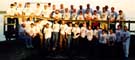
Spectacular Finishes and New Beginnings
 At a party at Michael Sutherland's home, in September 1997, a group of future land administration and land information experts was caught in the camers's eye.
Click on the thumbnail image to get a better look at the party animals, 30 KB.