More News from the Arctic
(Continued from here.)
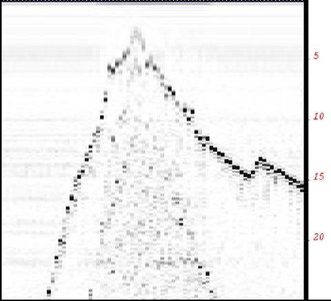
Ian recalls: "...we were steaming along through whitespace on the chart, we sort of assumed that the bridge had a better chart than we did, and all of a sudden the seafloor jumped from over 150 metres to about 2 metres. The ship pulled back the throttle and the Captain ran down to the acquisition room to see what we had passed over. By that time the depth was back to over 100 metres."
In fact, after reviewing the data records, it was found that the water depth dropped from 30 metres to 9 metres in less than 1 minute, leaving only 2 metres of water under the keel of the Amundsen. The shoal posed a significant hazard to navigation and the Canadian Hydrographic Service (CHS) was keenly interested in obtaining the position and depth information in order to pass on a warning to local mariners. The sounding information passed on to Jason Bartlett of the Burlington office of the CHS, another graduate of the department. The sounding depth and position is expected to appear in the form of a "Notice to Mariners" in the very near future. Chart #5705 will be updated with the sounding when the next edition is published.
For more information about notices to mariners, please visit www.notmar.ca
 |
| Location map showing the position of the uncharted shoal. |
 |
| The depth under keel is shown for several minutes before and after the discovery of the uncharted shoal. Depths are in metres, referenced to the echosounder. |


