| |
||||||
|
|
||||||
![]()
I
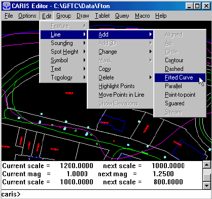
n this chapter, we will enter curve-fitted lines, point-to-point lines, parallel lines, and squared lines. Curve-fitted lines are defined at input by a small number of points, and the GIS will generate a smooth curve over these points to create the eventual line. They are suitable for smooth lines such as highways. Point-to-point lines are angular lines such as parcel boundaries. The operator must enter every one of its points. Parallel lines are generated at a distance from existing lines. Squared lines turn at 90† angles and are suitable for building outlines.
![]() Add
a curve-fitted line.
Add
a curve-fitted line.
1. Display all features. Select the Edit > Line > Add > Fitted Curve menu item.
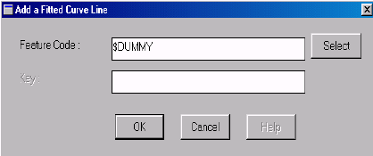
2. Enter the feature code. We will use $DUMMY to show that we are not entering anything real.
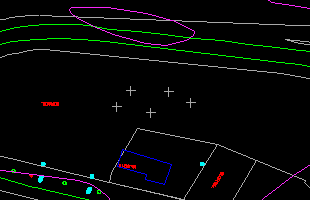
3. Use the crosshair to enter five points on the curve-fitted line.
(288525, 740609), 1: 800
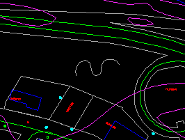
4. A smooth curve will be fitted over the five points. Click on the left mouse button to confirm.
5. Refresh the screen afterwards to show the updated map.
![]() The
demonstration Edit graphic data: adding a three-point curve in Demo 2
shows how to add a curve using three points.
The
demonstration Edit graphic data: adding a three-point curve in Demo 2
shows how to add a curve using three points.
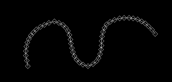
![]() Show
the points on the curve-fitted line.
Show
the points on the curve-fitted line.
Use a command we have introduced before to show the points making up the curved line we have just created.
![]()