![]()
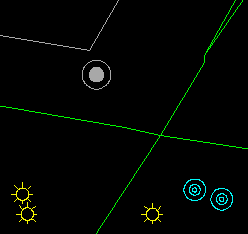
As indicators of elevation, spot heights and soundings have positions as well as numeric values. In the case of spot heights, their positions are indicated by symbols.

For a sounding, its location is not indicated by a symbol. Instead, the visual centre of the sounding is placed over the spot where its depth was taken. The term visual centre (or optical centre) means what an operator would estimate to be the centre of the sounding label. This could be different from the mathematically calculated centre of gravity.
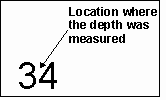
There are good cartographic reasons for this difference in presentation between a spot height and a sounding. Measurements on the ground are usually more accurate than those under water. Hence the use of a more precise point to indicate the position of a spot height is appropriate. The other reason is that there are a lot more soundings on a hydrographic chart than spot heights on a topographic map because of their importance to navigational safety. The already high density of soundings on a chart simply does not leave enough room for additional symbols.
![]() Add
a symbol.
Add
a symbol.
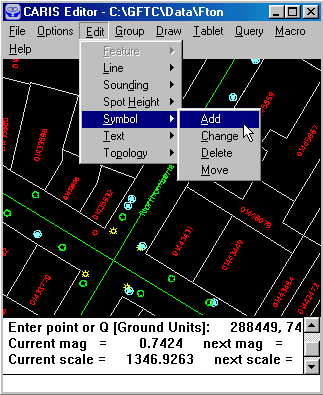
1. Select the Edit > Symbol > Add menu item.
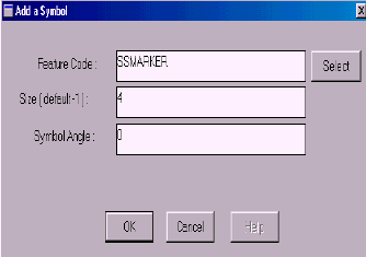
2. Enter the feature code, size, and angle for the symbol.NOTE Make sure the display parameter includes the feature code SSMARKER, otherwise you will not be able the see the symbol added.
3. Place the symbol at the desired location.
NOTE If you have entered a wrong feature code, and the symbol is undefined, you will see a question mark.
![]() The
demonstration Edit graphic data : Adding a symbol in Demo 2 shows how to
add a symbol.
The
demonstration Edit graphic data : Adding a symbol in Demo 2 shows how to
add a symbol.
![]() Try
other symbols.
Try
other symbols.
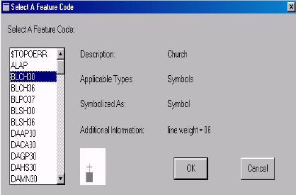
The symbols for the point features are controlled by their feature codes. Try other feature codes by clicking on the SELECT button in the Add a Symbol panel. If you click on a feature code, a description and a picture of it will appear.
![]()
