![]()
You could draw circles around the points by hand, but GIS provide functions that could automatically generate circles around points given a radius.
An area surrounding a feature is called a buffer zone or a corridor. Most of the GIS buffer zone generation commands will generate one that extends to a uniform width around the feature. The circle in the diagram is a buffer zone 10 metres from a point.
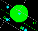
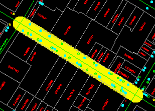
Buffer zones around lines form bands with rounded ends like the one in the diagram below. For scenic reasons in certain areas, logging of trees is prohibited along a band of a specific width on both sides of a highway. These bands can be represented by buffer zones around the highway.
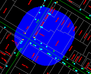
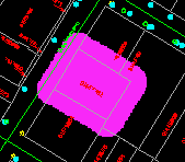
A buffer zone around a polygon is an expanded polygon. We will use such a buffer zone in this chapter to illustrate an application involving gasoline leakage from an underground storage tank.
Buffer zones are important tools in modeling, a technique of simulating reality using mathematical models. In this example, we will use a very simple model for gasoline tank leakage, which assumes that the leak affects an area 50 metres around the leaking tank. A more complicated model could involve the underlying geology and other factors. We are concerned with the total value of properties affected if such a leak does occur.
In the database, we do not know the exact location of the gasoline tank, but we do know the location of the gas station containing it. So instead of generating a 50-metre buffer zones around a gasoline tank, we will generate a 50-metre buffer around the property.
The next step is to retrieve the properties overlapping the zone and calculate the total property value from the attributes returned. Because we do not want to include the property value of the gas station in this analysis, the zone without the gas station is a ring.
![]() Generate
the outer buffer zone.
Generate
the outer buffer zone.
1. Pick a resolution of one metre on the ground.
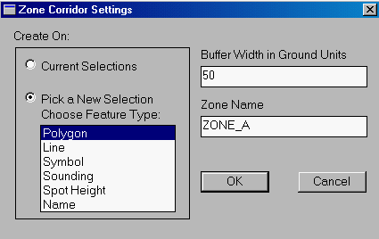
2. Select the Zone > Create > By Corridor ... menu item.
3. Turn on the Pick a New Selection switch, and enter a buffer width of 50 metres on the ground. This will create ZONE_A (or the next available name).
4. Choose a colour for the zone.
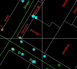
5. Point at the gas station property.
(288706, 740328), 1:500
6. A buffer will be generated around the gas station.
![]()
