![]()
In order to make the best use of the two formats, we might want to convert data from vector format to raster. There is also a need for the reverse conversion from raster to vector, although this conversion is much more complicated.
We will describe the conversion of vector polygons to raster zones. As explained in the chapter on Overlay Analysis, zones are composed of pixels with similar attributes and could be used in overlay analysis. They are different from raster images, which can only be used as backdrops.
![]() Make
a zone out of a polygon.
Make
a zone out of a polygon.
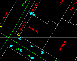
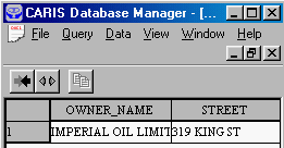
1. Use the MapQuery > By Pointing menu item to select and retrieve attributes for this parcel. It is a gas station owned by Imperial Oil Limited.
(288706, 740328), 1:500
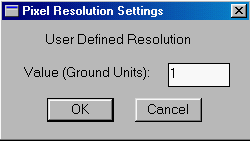
2. Pick the Zone > Pixel Resolution ... menu item. A panel appears to allow you to enter the resolution of the raster zone to be generated. Enter a ground resolution of one metre, and click on OK button
.
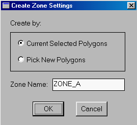
3. Pick the Utilities > Zone > Create > By Polygons ... menu item. A panel appears showing that a name, ZONE_A, has been generated automatically for the zone. You could assign a different name if you wish. Turn on the Current Selected Polygons switch since we have already formed a selection of polygons in a previous step.
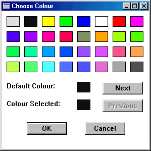
4. Choose a colour to draw the zone.
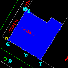
5. The raster version of the polygon will be shown on top of the vector version.
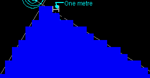
6. An enlarged part of it shows the pixels clearly. You can measure the size of them to verify that they are indeed one metre by one metre on the ground.
![]() Calculate
the area of the zone.
Calculate
the area of the zone.
1. Pick the Zone > Information ... menu item, and point at the zone you have just created.
2. The area of the zone in hectares will be shown.
For a raster representation, the area is computed simply by counting the number of pixels and multiplying the result with the area of a pixel, which is one square metre in this case.
![]()
