![]()
Thematic maps concentrate on the portrayal of a small number of geographical phenomena, and they are more specialized than topographic maps. Common types are soil maps, geological maps, population distribution maps, and land use distribution maps. They are not just produced by professional map makers but also by a much broader group of amateurs who need thematic maps for research, marketing, presentation, or other reasons. Whenever there is a need to include topographic features, thematic cartographers often base them on the official topographic maps.
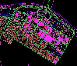
In this chapter, we will create a land use distribution map using the parcels as the base. To produce such a map, we will first identify the classes of land use to show and the colours to show them with. In this example, we will show the distribution of office complexes and retail stores. The method involved is quite simple - retrieve one type of land use from the database at a time and colour fill the selected parcels.
![]() Produce
a land use distribution map.
Produce
a land use distribution map.
1. Pick the Query > Query Condition ... menu item from the DB Manager window.
2. Retrieve office complexes (PROP_TYPE is 211).
3. Pick the Draw > Fill Polygon > Current Selections... menu item or the Fill Polygons iconfrom the CARIS Panel to fill the selected parcels with a colour of your choice.

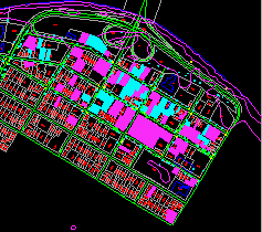
4. Repeat from step 1 to retrieve the retail stores (PROP_TYPE is 210), and fill them with a different colour. The map below shows both types of land use with the retail stores highlighted
![]() Save
the selections.
Save
the selections.
If you refresh the display, all the colour fills will disappear. Using the fill polygons command again will only colour the last selection consisting of retail stores. To avoid losing a selection, you can add it to an accumulation before starting a new one.
1. Select the office complexes as described earlier.
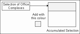
2. Pick the MapQuery > Accumulate Selections > Clear menu item to clear the accumulation. This is just to ensure that you start with a clean slate3. Pick the MapQuery > Accumulate Selections > Add ... menu item to place this selection in the accumulation. You will be asked to select a colour.
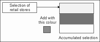
4. Repeat from step 1 to select the retail stores and add them to the accumulated selection with another colour. The accumulated selection will now contain two selections.
5. To display the two selections, pick the Draw > Fill Polygons > Accumulated Selections menu item.
![]()


