![]()
Some of these attributes are common to many features, while others are different from one feature type to another. For instance, attributes related to geometrical representations are common to many. Other attributes, such as the owner of parcels and the highway surface type, are quite specific to certain types of features.
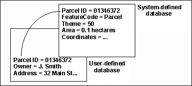
In this GIS, we distinguish a set of system-defined attributes that are common to many features, and a set of user-defined attributes that are specific to feature types. For system-defined attributes, the GIS has already allocated spaces for their storage in the database, and the meaning of them has been defined by the system as well. Feature code, feature key, theme number, and others that we have discussed while using the Information icon on the CARIS Panel are some of the system-defined attributes.
Take the feature code as an example. The users have the freedom to design the codes in whichever fashion they wish as long as they satisfy certain restrictions: they must be within 12 characters long in this GIS and reflect the feature types. Once the codes have been designed, the GIS provides the mechanism to enforce their use. Moreover, the GIS uses the codes to control the colour and symbology of the features on a display.
Software modules in the GIS make extensive use of the system-defined attributes in its operation. Any deviation from the expected usage of these variables could cause nasty surprises.
The user-defined attributes vary so much from one feature type to another that it would be difficult for the system to exercise complete control over them. Even for a single feature type, such as a highway, the number of attributes associated with them can vary from one application to another. Hence the number and the meaning of these attributes are left mainly to the user. The GIS only allocates spaces for them at the request of the user and provides limited tools to retrieve and manipulate them.
Some GIS store both system-defined and user-defined attributes in the
same database, but others store them separately. In our GIS, as well in
several others on the market, such as Arc/Info and Intergraph, two
databases are used.
The contents of the system-defined database are controlled by the GIS. The
user-defined database consists of a number of relational tables that can
be used in conjunction with the system-defined database or separately as
an independent relational database.
A link is established between the two databases to form a collective set of attributes. In our GIS, we use the feature key, which is a unique identifier for the feature, as the link. The example here shows that the parcel identification code is used to link the attributes from the two databases.

Some features are without keys, indicating that they are not associated with user-defined attributes.
![]() Display
user-defined attributes of a feature.
Display
user-defined attributes of a feature.
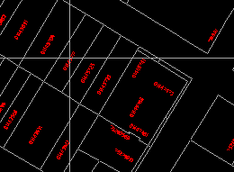
1. Use the Options > Display > Visibility Parameters ... menu item to display only data belonging to theme 50, the layer of land parcels.
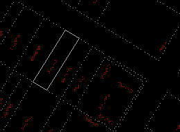
2. Use the MapQuery > By Pointing menu item to select the parcel (01445717) shown in the diagram. You can point at anywhere within the parcel to select it.
(288577, 740339), 1: 800
3. The outline of the parcel will be highlighted. Click on the left mouse button to confirm that this is the parcel you want.
4. The crosshair will reappear for you to form a larger collection of features by selecting others. We only want to select one in this example, so click on the right mouse button to exit.
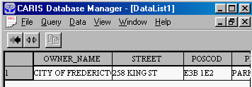
5. The database manager, which manages the user-defined database, retrieves the attributes of the selected parcel. You can enlarge this window or use the scroll bar at the bottom of this window to see the other attributes.
![]()


