![]()
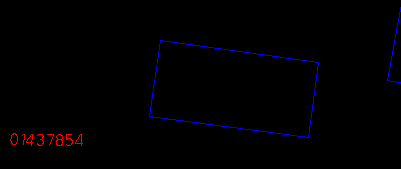
As in distance measurements, area measurements are also based on coordinates. The coordinate system used has therefore an effect on the size of the areas computed. We will use the outline of a house in the database to illustrate this point.
![]() Compute
area.
Compute
area.
1. Centre at (287914, 740615) and choose a display scale of 1:500.
2. Select the Options > Pointing Method .. menu item, turn on the snapping to a feature switch, and click on OK buttonto exit.
(287914, 740615), 1:500
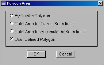
3. Select the MapQuery > Polygon Area ... menu item, turn on the User Defined Polygon switch, and click on OK button
to exit.
The switch allows you to define a polygon anywhere on the display window and have its area calculated. Since we have the snapping to a feature option turned on, we will be using the existing corners of the house and hence will compute the plan area of the house.
4. Point at the four corners of the house in either a clockwise or a counterclockwise order. Then click on the right mouse button to terminate.
The GIS knows that you are measuring an area, and therefore will close off the outline of the house automatically. You could enter the fifth point if you wish, and click on the right mouse button to finish.
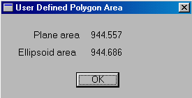
5. Area measurement, like distance measurement, is performed on both the flat map surface and on the curved ellipsoidal earth. The slight difference of 0.125 square metres in this example is the result of area distortion introduced by the map projection used.
![]()


